 |
|||||||
There are multiple different types of radar. All of the radars work off of the basic principle of the radar equation as found in the principles section.
Doppler Radar: Dopplerizing an existing radar adds the capability of measuring wind direction and speed by measuring the Doppler effect. The radar measures what is called radial velocity. This is the component of the wind going either toward or away from the radar.
There are currently two different types of radar that are being experimented with. The first type that is in the final stages of development is dual-polarized radar. The other that is being worked on is bistatic radar.
Dual Wavelength Polarized Radar: This is actually an upgrade to the existing radar principle like the addition of Doppler was. Since the current WSR-88D's is to be upgraded to this type of radar by the year 2005, it would be helpful to take a look at what this upgrade will do for us. With dual-polarization, there is the use of two or more wavelengths. This permits the extraction of additional information about the different meteorological targets. The radar echo of the targets changes with wavelength. The reflectivity of small targets, targets that are much smaller than the radar wavelength, is similar at two different wavelengths. For large targets like wet snowflakes and hail, the reflectivity differs. This helps solve the problem mentioned above referring to the raindrop size and its reflectivity. Size of the particle will be something that the radar can determine. This will allow for more information on the storm processes, and help forecast and warn on storms better. Also, with the dual-polarization, there is a dual-wavelength signature for large hail. Currently in on-going research, this type of radar can see more than just rain in the clouds. Dual-polarized radar can determine the following parts of a thunderstorm: Cloud Drops, Drizzle, Light Rain, Moderate Rain, Heavy Rain, Hail, Rain/Hail, Graupel/Small Hail, Graupel/Rain, Dry Snow, Wet Snow, Ice Crystals, Irregular Ice Crystals, Super-Cooled Liquid Water Droplets, and Insects.
 Bistatic
Radar: This is probably the newest instrument on the horizon for
radar since it was created in 1994. In the past, a problem occurred in detecting
the wind structure of a thunderstorm with a single Doppler radar. This was
a problem because if the winds were flowing perpendicular to the radar beam,
it could not resolve which direction they were flowing from. This problem
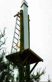
is corrected with bistatic radars. In a bistatic system, there is at least
one bistatic receiver and one single traditional monostatic weather radar.
In this system, the weather radar transmits a narrow beam and receives the
backscattered radiation. At the same time, one or more passive bistatic receivers
recover some of the other scattered radiation. Since this gives multiple angles
on the wind, many components of the wind can be measured simultaneously. This
creates the possibility of directly measuring 3-D winds with a single radar
system. There currently is only one bistatic radar network set up in the world.
That network is set up around the Montreal airport in Canada. The preliminary
results have been very promising, especially in areas like airports that require
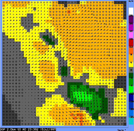
a good understanding of wind flow. An example of the data is below. One can
see below in the data the direction and speed of the winds. This solves the
problem that single dopplers have. Single dopplers can only see wind direction
toward or away from the radar.

Above two images are courtesy McGill University
For questions or comments about this page, please visit our "Contact Us" page.
Created
by Adam Frederick, webmaster@severewx.com
Content and Images (unless otherwise noted) Copyright 1999 Adam Frederick
Last updated 07/21/99 10:02 PM