
|
|
Even though it was mid October, there was a threat of storms that day. After I got done with classes, a severe thunderstorm was issued for the county to our north. I grabbed a chase partner and we left. We didn't really expect to see much that day because it was cold and also because of the time of year. When we got to the storm, it was just producing heavy rain. As we headed back south, we heard the EAS go off on the radio. There was now a tornado warning on a new storm just to our east. The tornado warning had only been issued for a period of 10 minutes when it expired and was extended with the severe thunderstorm warning below. We ended up following behind the storm. We really didn't want to get in front of it, and we couldn't get to the south of it either. When looking at the storm, we could see the hail shaft below.
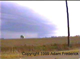
The storm continued to move to the east north east at a relatively slow rate of speed. As we drove into Marshalltown, we saw this cloud from the east side rising into the sky. At this point we didn't know what it was.
Later on, we ended up south of the storm when it decided to take a turn to the south. We started to get hit with hail, but the largest hail was probably marble sized. We took shelter at a gas station where I could park the car under the canopy for the gas pumps. The storm ended up producing heavy rain and lots of lightning. To view more video captures from this chase, check out the Photo Gallery section for 1998 Video Captures.
|
||
DISCLAIMER: Remember storm chasing exposes chasers to many hazardous and potentially deadly weather conditions such as lightning, dangerous roads, damaging winds, hail, and flying debris which puts the chaser's life at risk, particularly those who have little or no experience and/or storm structure education. Learning to deal with these is best done by understanding supercells and thunderstorms, and riding with an experienced chaser before attempting to chase on their own. The author of these pages does not encourage storm chasing and is therefore not responsible for any actions as a result of what is seen here! For video or picture sales, questions or comments, please visit our Contact Us page. Pictures and content on this web site, unless otherwise noted, are Copyright 2001 Weather Edge. and may not be reproduced without written consent. For problems, questions or comments regarding this site, please visit our Contact Us page. Web site created by Weather Edge Inc. For your web design needs, please visit http://www.weatheredge.com. |
|||

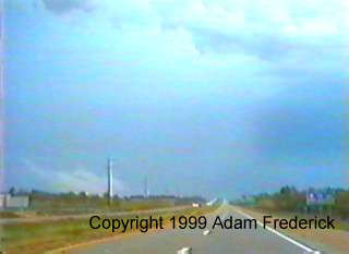
 That
vertical white section from the middle to the left of the picture was
hail. It ended up being small hail, but it fell in large quantities.
That
vertical white section from the middle to the left of the picture was
hail. It ended up being small hail, but it fell in large quantities.
 It
turned out that the cloud was fog coming up off of farm fields with
four to five inches of hail on the ground. We continued to follow highway
30 a hail covered highway 30. As seen in the picture below, it looked
like it had snowed.
It
turned out that the cloud was fog coming up off of farm fields with
four to five inches of hail on the ground. We continued to follow highway
30 a hail covered highway 30. As seen in the picture below, it looked
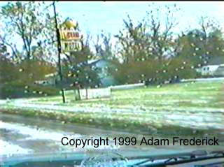
like it had snowed.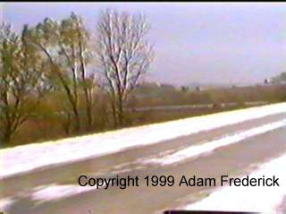 The
hail was so high as times, the bottom of the car was hitting it.
The trucks that went by almost acted like snow plows as they shoved
the hail from some of the higher spots off the road and also into our
lane. As we got into La Grande, it also looked like it had snowed.
The
hail was so high as times, the bottom of the car was hitting it.
The trucks that went by almost acted like snow plows as they shoved
the hail from some of the higher spots off the road and also into our
lane. As we got into La Grande, it also looked like it had snowed.
 As
the storm continued east, one final warning was issued for it.
As
the storm continued east, one final warning was issued for it.